Reaches

McKay Creek

a stream in the forest

Restoring McKay Creek's Natural Flows

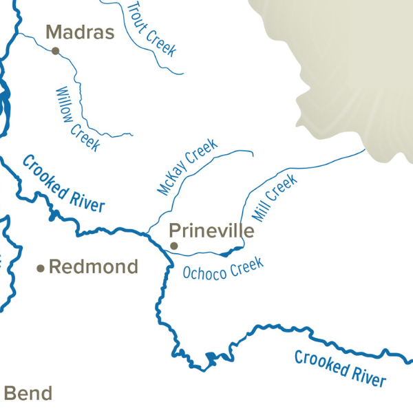
McKay Creek flows 37 miles from its headwaters in the Ochoco National Forest, through private agricultural lands, and joins the Crooked River just northwest of Prineville in Crook County.

The dominant private land use along the creek is livestock and irrigated forage production, using water from the creek. Due in part to irrigation diversions, flows are low or intermittent in the middle reach during the irrigation season, limiting fish movement and contributing to insufficient aquatic habitat, resulting in high stream temperatures.

The McKay Creek Water Rights Switch (the Switch) will restore natural flow to the middle reach of McKay Creek by allowing landowners from river miles 6 to 12 to trade their private McKay Creek water rights for Ochoco Irrigation District (OID) water rights, sourced from Prineville Reservoir. In exchange for more reliable OID water, landowners will transfer 11.2 CFS of certificated McKay Creek water rights instream. Restoring the natural hydrograph in this reach of McKay Creek will address many limiting factors, including low flow, altered hydrology, high water temperature and impaired fish passage.

For Landowners, the Switch provides:

  • Water users the opportunity to hold more reliable water rights

  • Potential increase in property value associated with more reliable water rights

For the Irrigation District (OID), the Switch provides:

  • Stability of their assessment base for future urbanization by adding additional patrons

Indistrict (Miles 1-6)

Water users from the confluence of McKay Creek and the Crooked River to approximately river mile 6 are patrons of OID and serviced with water from Prineville Reservoir. This reach of the creek does not experience low stream-flows, due in part to the return of irrigation water to the creek.

Out of District (Miles 6- 12)

Water users from approximately river mile 6 to river mile 12 divert water directly from McKay Creek contributing to critically low and intermittent streamflow conditions earlier in the summer than would naturally occur. These diversions can create fish passage barriers and contribute to high stream temperatures.

Part of Bigger Picture (Miles 12+)

Removing all private irrigation diversions from McKay Creek eliminates the need for diversion structures that create passage barriers for migrating fish and optimizes habitat restoration and land conservation opportunities.

The Switch will help leverage the work of our partners in these ways:

  • Protect water restored to McKay Creek from Forest Service floodplain restoration projects upstream of the Switch.

  • Provide opportunities for riparian land conservation with the Deschutes Land Trust and habitat restoration opportunities with the Crooked River Watershed Council.

McKay Creek Map
Wildlife Inhabitants:

Steelhead trout

Redband trout

Spawning and rearing grounds

Progress: (Goal: 11.2 CFS)

+11.2 CFS (in progress)

Challenges:

Streamflow

Water Quality (temperature)

Fish and Wildlife Habitat

Solutions:

Irrigation Water Source Switch

Transferring Water Rights Instream

An aerial view of a body of water.